Saturday, April 27, 2013
Marathon Traffic Data
Over at Unconventional Data, we look at Boston Marathon real-time traffic maps (thanks, Google Maps) and how runners feed bad data in to the system. Well, data.
Friday, April 19, 2013
Station Name Creep
Jarrett Walker tweeted today about a piece he wrote a few years back on his blog regarding corporate naming for train stations. While I agree that it is a pretty dumb idea to have mindless corporate naming rights ("get on the train at Bank of America, change at Gillette and get off three stops later at Novartis"), station names in Boston have changed, rather drastically, over the years. Someone dropped in from 1950 would barely recognize station names today, even though the lines in the core of the city haven't changed in the past 50 years. So, where appropriate, I think name changes are not the end of the world, and if they help direction finding without overly-lengthening the name, may help.
Here's a quick rundown:
Haymarket was originally Union-Friend, named for nearby streets. It was extensively rebuilt in the 1970s. (Wikipedia)
Government Center was originally Scollay (and Scollay Under for the Blue Line), named for the square above. It was obliterated by the Government Center construction in the 1960s (when the line was rerouted and the neighborhood leveled. (Wikipedia)
Hynes was originally Massachusetts, named for the Mass Ave. It then changed to Auditorium, then to Hynes Convention Center-ICA and, when the ICA moved, to Hynes Convention Center. During automated station announcements, the announcement sounds choppy at the end, as they just clipped the audio file when the station was renamed. (Wikipedia)
Prudential was originally Mechanics, named for the meeting hall which stood nearby, and changed when the Pru was built in the 1960s. (Wikipedia)
Kendall and Charles have both been modified to Kendall-MIT and Charles-MGH over the years.
Downtown Crossing was originally Washington, Winter and Summer. This is one of several Orange Line stations which has offset platforms named after multiple streets (and Washington was named after Washington Street of course). The Orange Line came first here, and the station wasn't renamed to a single transfer point until 1967, when Winter and Summer were dropped, and 1985, when it as changed to Downtown Crossing. So although things didn't change from 1944 to 1965, Tom Lehrer's Subway Song today would be out-of-date. (Wikipedia)
Washington Street was originally the only street along Boston Neck and carried the Post Road to New York. As the main street, intersecting streets changed names when they crossed Washington (which doesn't help the whole Boston is impossible to navigate thing). And because the BERy named subway stations for their intersecting streets, different platforms got different names (the Washington Street Subway had no center platforms). So, Friend-Union, Winter-Summer and …
Chinatown was originally Boylston and Essex. Boylston on the southbound side, Essex going north. Was it a problem that there was a separate Boylston station a block away? Apparently not. (Wikipedia)
State was originally Milk and State on the Orange Line and Devonshire on the Blue Line. It was, for a time, actually called State/Citizens Bank as Citizens was trying to get the whole area renamed for them, but that lapsed and the name reverted to State. (I don't think any system maps were ever displayed with this travesty of a name.) State was probably retained over other names because it is located at the old State House, in addition to being on State Street. Along with Park, it is the only main transfer station that hasn't been renamed completely. (Wikipedia)
Aquarium was originally Atlantic (for the Avenue, not the ocean).
There's a good animated GIF of the changes over time here.
Friday, April 12, 2013
Midnight Marathon Tips
Recently we've been on about the Midnight Marathon, when 700+ cyclists take a train to the Boston Marathon start line and, at midnight, bike back. Well, the race sold out, we posted some suggestions (*) on how to participate if you didn't snag a ticket (we did). Today the Boston SOS asked for suggestions on their website. As a bike commuter, professional evangelizer and possible blowhard, here are some suggestions to having a safe, fun ride:
- Choose a comfortable bike right for the conditions. I, for instance, have three bikes to choose from:
- I could take my road bike. The pros: it's fast and rides dreamily. The cons: do I want to have my carbon bike jostled amongst other bikes on the train, if the road is wet it won't be that great a ride, it doesn't have a fender, and I'd have to wear by not-walky bike shoes. Also, if I want to carry a bag (with layers and street shoes, perhaps) it's less conducive to a comfortable riding position.
- I could ride my mountain/commuter bike. The pros: it's reasonably road-worthy. There's less of a chance of flatting out compared with the road bike. I can walk in the cleats, and it's a little more comfortable from a bag position. Oh, and it has a fender if it's wet. The cons: it's certainly not up to roadie speed, but it's also no slouch. So I might not be taking pulls, but I can probably do some drafting. Plus, I got the brakes repaired last spring. The granny gear is a little sticky to get in and out of, but I doubt I'll need it on the mostly-downhill route. I'll probably go this direction, unless I really want to go fast. But in the dark, speed is not necessarily your friend.
- I could ride a Hubway. The pros: pretty comfy for short rides, and it has a basket. The cons: It's heavy as sin. And slow—good luck breaking 20 mph except on the longest downhill. It's a bear to get on to the train. And at the end of the ride, I'd have to bike it back to Central and then walk home at 2:00. Oh, wait, I'd be on a Hubway. 3:00. Plus, if they don't waive fees (they probably will) it's a pricey ride.
- Wear comfortable clothing, bring layers, and if it might rain, bring something rainworthy. Last year, we stood in the rain for an hour while everyone detrained, and then the first uphill to Hopkinton was pretty wet. It wasn't cold—the next day would be scorching hot, remember—but with wind and rain it was not a good time to be in jeans. This year looks dry and seasonably cool, with temperatures during the ride in the upper 30s and light winds. Certainly bring and wear gloves. And remember that at 20 mph there's a bit of a wind chill. Brr!
- Bring some flat-fixin' stuff. Other people will have it, sure. And bicyclists love each other. (Last week, after I blew out a tire in Arlington, a passerby brought me a new tube and floor pump. Hooray!) But still. Bring a patch kit, and maybe even a spare tube. If you can't use it, someone else can.
- Bring lights. You know what, bold isn't enough here. BRING LIGHTS. And while we are at it, WEAR A HELMET. First, lights. State law stipulates a front headlight and a rear reflector or light. Bring a rear light. Or two. The more light, the merrier. Sure, everyone else will have lights. But there are cars along the route. And you want them to see you. Plus, everyone else has lights which is really cool:
While we're at it, helmets. For god's sake, wear a helmet. I do not need to explain this. - Obey the laws. The lights are a law. Staying in the right lane is a law. Not running red lights is a law. While you might skip the letter of the law, at least comply with the idea of the law. Don't get hurt, and don't unnecessarily piss off motorists (not that you'll see many). And don't bike down 135 at 40 mph in the left lane. The roads are open to traffic. There's just not much of it.
- Don't get your ass kicked by the police. Okay, that was a Chris Rock reference; more to the point: if the cops show up, do what they say. Last year, a couple of Southborough cops showed up at Southborough, and then left when they saw there wasn't much fuss. But last year pretty much no one knew what was going on except those of us on the train. This year, we've been all over the Globe and social media, so there might be cops out patrolling in various towns along the route. They're there for our safety. Be nice to them.
- Know the route. The route is well-marked and pretty intuitive. Basically, follow the port-a-johns. A quick primer for the route:
- Start on Route 135. It's downhill at the start. A lot.
- There is a traffic light in Ashland on a downhill. You might be going 40, so you might have to brake. A lot.
- There are DIAGONAL RAILROAD TRACKS on both sides of Framingham. Last year it was wet and there were lots of crashes and some injuries here. Even if it's dry, slow down and turn to cross them perpendicular. And let others know about it, too.
- 135 merges with 16 in Wellesley, but there's no real turn.
- You'll begin to see some more traffic around Route 128.
- About a mile after 128—half a mile past the Woodland T stop and Newton Wellesley—the course turns up Commonwealth Avenue at mile 17.4. These are the Newton Hills. There's a firehouse on your right. (I grew up a block from here, too.) Take a right on to Commonwealth. If you get to West Newton and the Mass Pike entrance, you've gone (a mile) too far.
- There are three major hills in Newton. The first climbs about 100 feet over half a mile, and there is then a gradual descent to Walnut Street (City Hall). For there, it's another 100 feet up Heartbreak Hill, followed by a flat section across Centre Street. Then it's another 100 feet up to Hammond Street, followed by a screaming descent through BC.
- Once you cross in to Boston, traffic will pick up. The streetcar tracks are in the median to your left.
- At about mile 22, you take a right on to Chestnut Hill Avenue and a left on to Beacon Street. A few very important notes:
- Chestnut Hill Avenue has embedded streetcar tracks. Stay in the right lane to avoid these. There shouldn't be much traffic, but this is not a place to speed up. I can tell you from experience that if you put your wheel in the track you will go down. The one time I did that I somehow flipped over the bike, unclipped and somehow landed on my feet, but I wouldn't want to try that again.
- At the bottom of the hill in Cleveland Circle, you take a left on to Beacon. There's a pretty elaborate light, and you'll be taking a left on to the inbound lanes to the right of the streetcar tracks in the median.
- Speaking of which, holy streetcar tracks, batman. There are lots of tracks in Cleveland Circle. Slow the fuck down and don't die, okay?
- Beacon Street is nicely paved and has a bike lane. And some traffic. Watch the downhill in to the light at Washington Square.
- After Kenmore Square, the marathon route crosses under Mass Ave. At the Bowker Overpass (Charlesgate) get over to the left (there's a left-hand bike lane) to go through the underpass.
- The marathon route then takes a right on to Hereford. This street is one way in the opposite direction. It's only two blocks, and it's not well-traveled at this time of night. Plus it may already be closed to traffic and certainly won't have any parked cars. Still, go slowly and watch for oncoming traffic. Or go another block to Gloucester (not quite the official course).
- Take a left on Boylston. And sprint to the finish!
- Hang out at the end, especially if you are an early finisher. The marathon folks had no issue with us hanging around in their finish pens last year; how nice of them! Cheer on your compadres as they come down Boylston. Make some friends, and see if there's anyone going home in your direction (or to an all-night eatery; stupid Boston won't let us drink after 2 a.m.). Then, once you're ready, head home. With 1000 cyclists (or so), for the first few miles, you might have some company.
It should be fun!
(*) According to the Midnight Marathon FAQ, bikes won't be allowed on other trains. However, according to MBTA policies, they are. If you are taking another train (9:20 to Franklin, 8:30 to Framingham) consider printing out or having on your phone the MBTA bike policies, and be firm but polite with both MBCR staff and non-biking customers. Kindness goes a long way. And if they don't let you on and you're still keen to ride, you can probably bike to the start by the time the train loads, travels, unloads and then we all make our way to the start.
Monday, April 8, 2013
Moving Bicycles, part deux
Update: the train sold out in 12 hours.
A few weeks ago, I wrote about trainloads of bicycles. The Boston Globe has an article about the bike train, and it's trending in their most viewed list. It should be exciting; I'm hoping the line for tickets isn't too long over at South Station (I'm headed over there later to buy my ticket).
Now, it's entirely possible that fewer than 700 bicyclists will buy tickets, and there will be no mad rush or secondary market. It's also possible the train will sell out. (I'm only buying one ticket, buying extras to make a profit seems a bit uncouth.) In that case, here is Ari's Unofficial Guide (I've written other unofficial guides in the past) To Getting To Southborough If You Can't Get On The Train. In order of feasibility:
- Take the 8:30 and bike out to Hopkinton from Framingham. It's 7 miles from Framingham to Hopkinton, which is only 4 miles further than the ride from Southborough. The train gets in at 9:20, which gives you a good hour and a half to bike up the hill to the start. If you were really keen, you could bike out to Southborough (6.5 miles) and join the ride there. One caveat is that they may be somewhat reticent to put a bunch of bikes on this train, but since Framingham is the final stop getting all the bikes off won't delay any other passengers. Just make sure to leave room for the "normals" on the train. Need to kill an hour? There's a bar in Ashland right on the course. Hopkinton isn't dry, but there don't seem to be many bars there. Update: The MBCR tweeted that it is a "regular train with room for only a few bikes." So if you take it, arrive early, board early, and then get ready to get off quickly in Framingham. This train turns and is the 9:45 back to Boston, so it can't stand to get delayed by an hour. Make sure to leave a couple of cars bike-free for non-cyclists. And consider buying a higher-zone pass to give the T some extra dollar bills.
- Take the 9:20 to Franklin. At 13.1 miles, this is a longer ride than the Framingham option, but it does leave a bit later. The train gets in to Franklin at 10:12, more than half an hour before the extra train gets to Southborough. From there it's a ride mostly along back roads with one big hill at the end in to Hopkinton (the ride from Norfolk, the stop before Franklin, is not much longer, and you get an extra 7 minutes to ride). It's probably a very nice ride, but you should be able to ride it in an hour to meet the rest of the gang from the Extra. Assuming a 45 minute run time, the Extra will arrive at 10:45 and should be done unloading by 11:15, and it's a 15 minute-or-so ride to the start from there. If you can ride 12 m.p.h. you should be able to get to the start around the same time. (i.e. don't try to do this on a Hubway, but if you're a roadie, you should be fine.) See the suggestions above to keep the train, and yourself, on schedule.
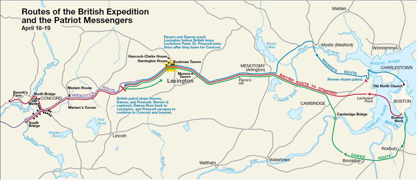
- Just get on your bike and ride! Who's not up for a metric century in the dark, anyway? You could trace Paul Revere's footsteps (that's what the holiday is all about—it's not just a random day off for government workers) and ride up the Minuteman to Lexington and on to Concord. (This is more like 70 miles, and more if you follow Paul Revere's route through Charlestown and Medford.) Then drop south to Cortaville/Southborough, meet the train, and ride on.
- Play coy, catch the 11:00 to Framingham and ride from there. For this option, get on the 11:00 train and buy a ticket to Framingham. Tell the conductor that you live there and are riding home, and that is within the bike regulations of the T. The train gets in to Framingham at 11:50, so you would have plenty of time to detrain and bike backwards on the course to go and meet the rest of the ride (or just hang out in Framingham; the first riders will shoot down the early hills in 15 minutes easily). You wouldn't get the full experience, but it would work, in a pinch. Major caveat: even if you cite policy, they might not let you on this train.
- Play coy and try to catch the 11:00 to Southborough. (Not Suggested) Word on the street is that bikes won't be allowed on the late train. There's a canard that it will be full from Red Sox traffic from the game which starts at 1:00; I don't believe this. But they don't want a ton of bikes clogging the train and slowing it down; that's why they're running the extra. Still, it might work as an option, but I wouldn't suggest it. If you were to take it, you'd arrive at midnight, and have a tough time getting to Hopkinton by the start, although you could probably catch some stragglers. If you are going to do this, I'd suggest buying a ticket to Worcester, claiming that's your final destination, and getting off at Southborough. Unless there's no one else getting off there. Have fun biking home from Worcester. (Actually, this train turns in Worcester and runs back to South Station, so you'd get a nice, dark train ride. Fun!) Anyway, don't do this.
Whatever you do, be sure to express gratitude towards the MBCR employees—who are mostly volunteering for the event!—and the T in general. And ride safe.
Subscribe to:
Posts (Atom)